A. J. Barnett Cemetery
Estill County, Kentucky
“Among these hills and hollers, their stories rest.”

Cemetery Location and Research Status
A. J. Barnett Cemetery is historically described as being near Frames Branch Road and Plum Branch in Estill County. The approach is believed to have been through the Hardwicks Creek area of neighboring Powell County. Old descriptions, family records, maps, and the shape of the land all place the cemetery within this general area, but time, vegetation, weather, and changing land use may have obscured the surviving stones and original access route.
Estill County, Kentucky
View the approximate area
How the research area was identified
- Historical and local descriptions place the cemetery off Frames Road near Plum Branch.
- The 1952 Clay City USGS topographic map shows former cleared ground and older settlement features in the area.
- Present-day aerial imagery was compared with the older roads, branches, clearings, and terrain.
- Kentucky From Above Phase 2 LiDAR hillshade was examined for landforms and possible surviving access patterns beneath the tree cover.
- The working coordinates were also compared with the rectified 1905 historical map used in the Estill County cemetery research project.
Confirmed Burials
Each individual listed below has been confirmed as buried in A. J. Barnett Cemetery. Linked icons open the supporting death certificate, headstone photograph, obituary, or newspaper notice held with this research.
 Death certificate
 Headstone photograph
 Obituary or newspaper notice
| Surname | First Name | Maiden Name | Date of Birth | Date of Death | Parents | Place of Birth | Place of Death | Newspaper | Newspaper Date | Records |
|---|---|---|---|---|---|---|---|---|---|---|
| Barnett | Amanda “Mandy” | Highley | July 7, 1924 | The Clay City Times | July 10, 1924 | 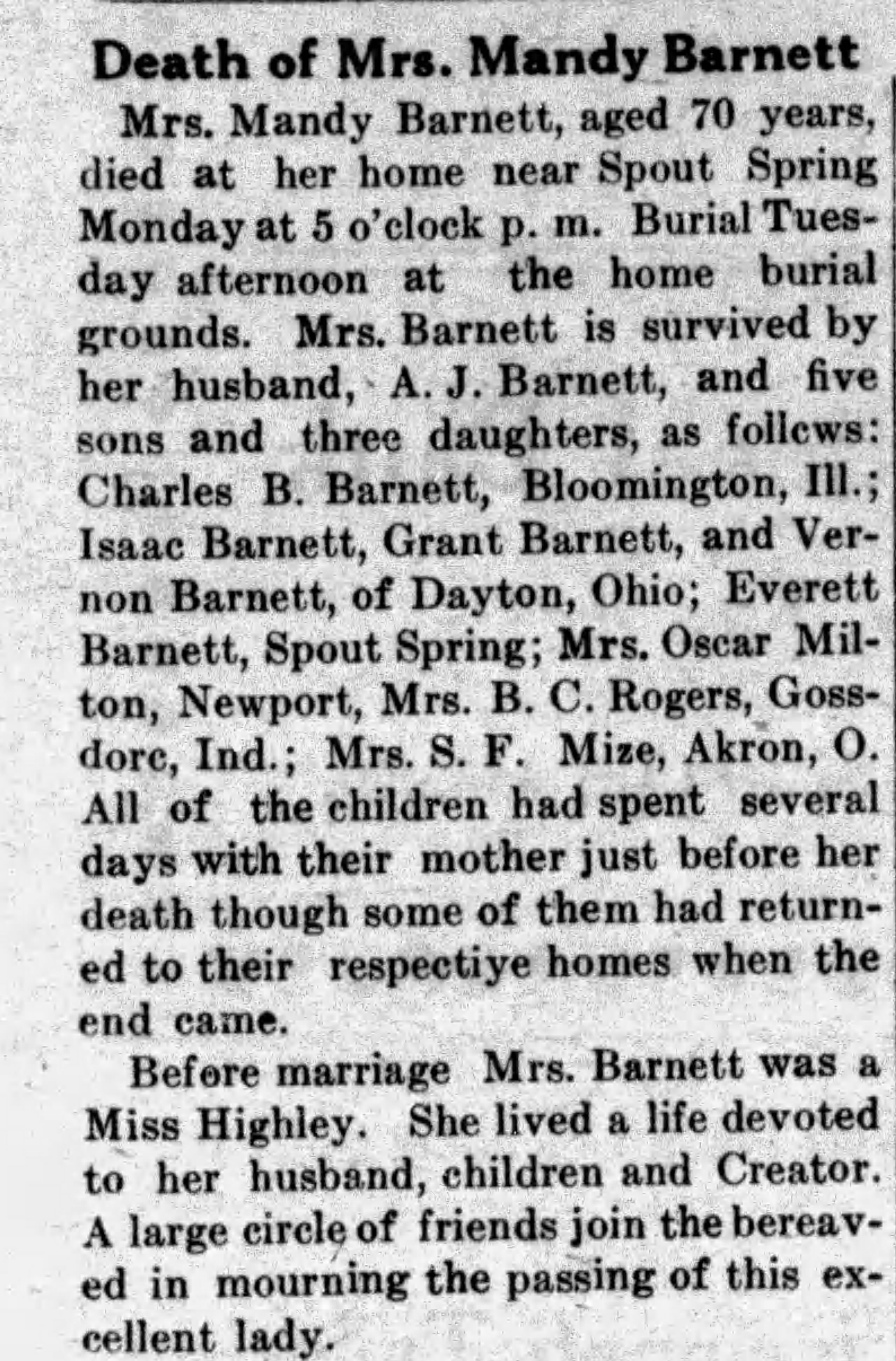 |
||||
| Barnett | Andy | October 29, 1809 | September 2, 1928 | Franklin Barnett & Nancy Elkins | Kentucky | Estill County, Kentucky | The Clay City Times | September 6, 1928 |
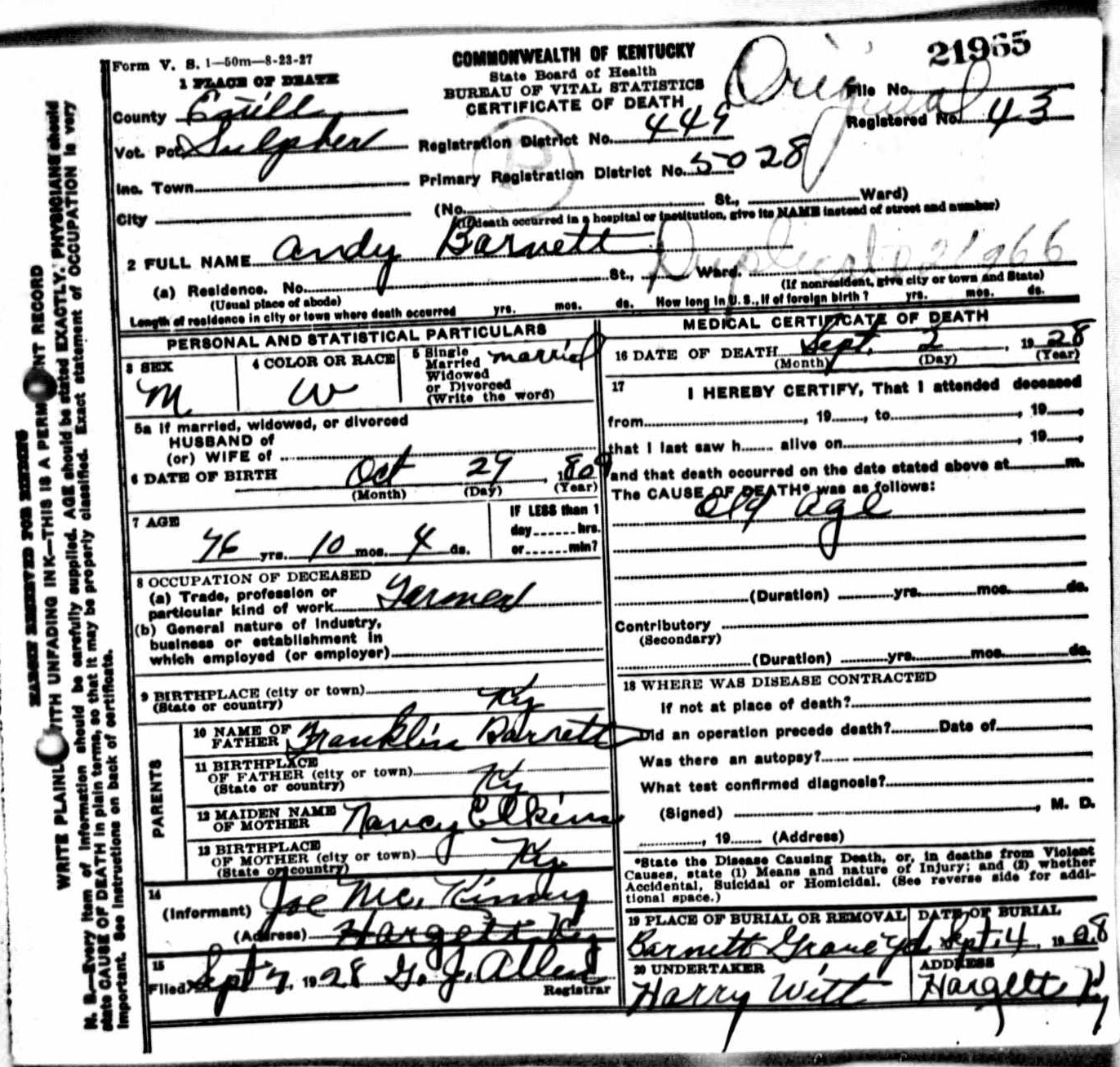
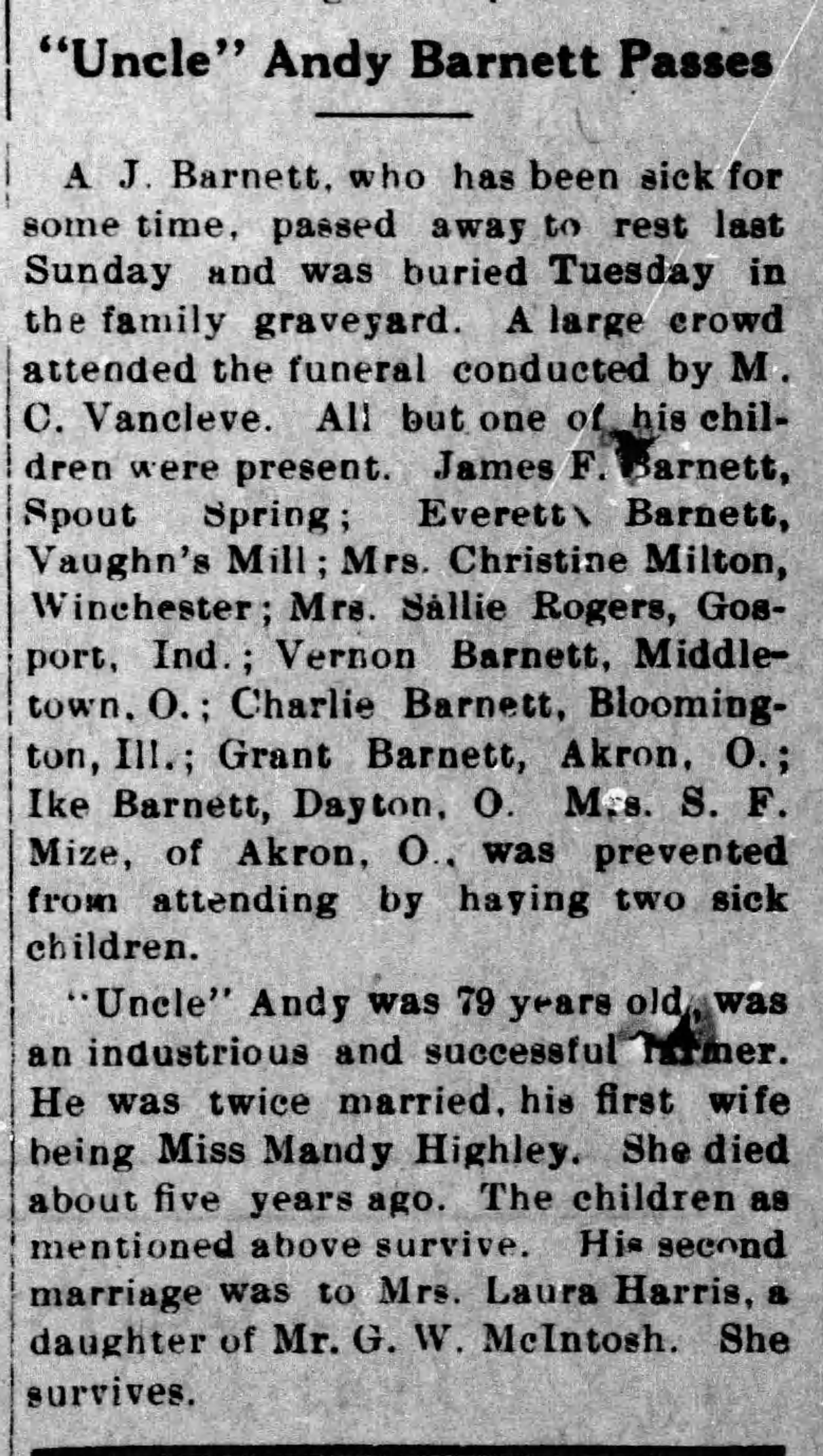
|
|
| Barnett | Easter Adelene | March 20, 1998 | Joe Rogers & Lula Abney | Lexington Herald-Leader | March 22, 1998 |
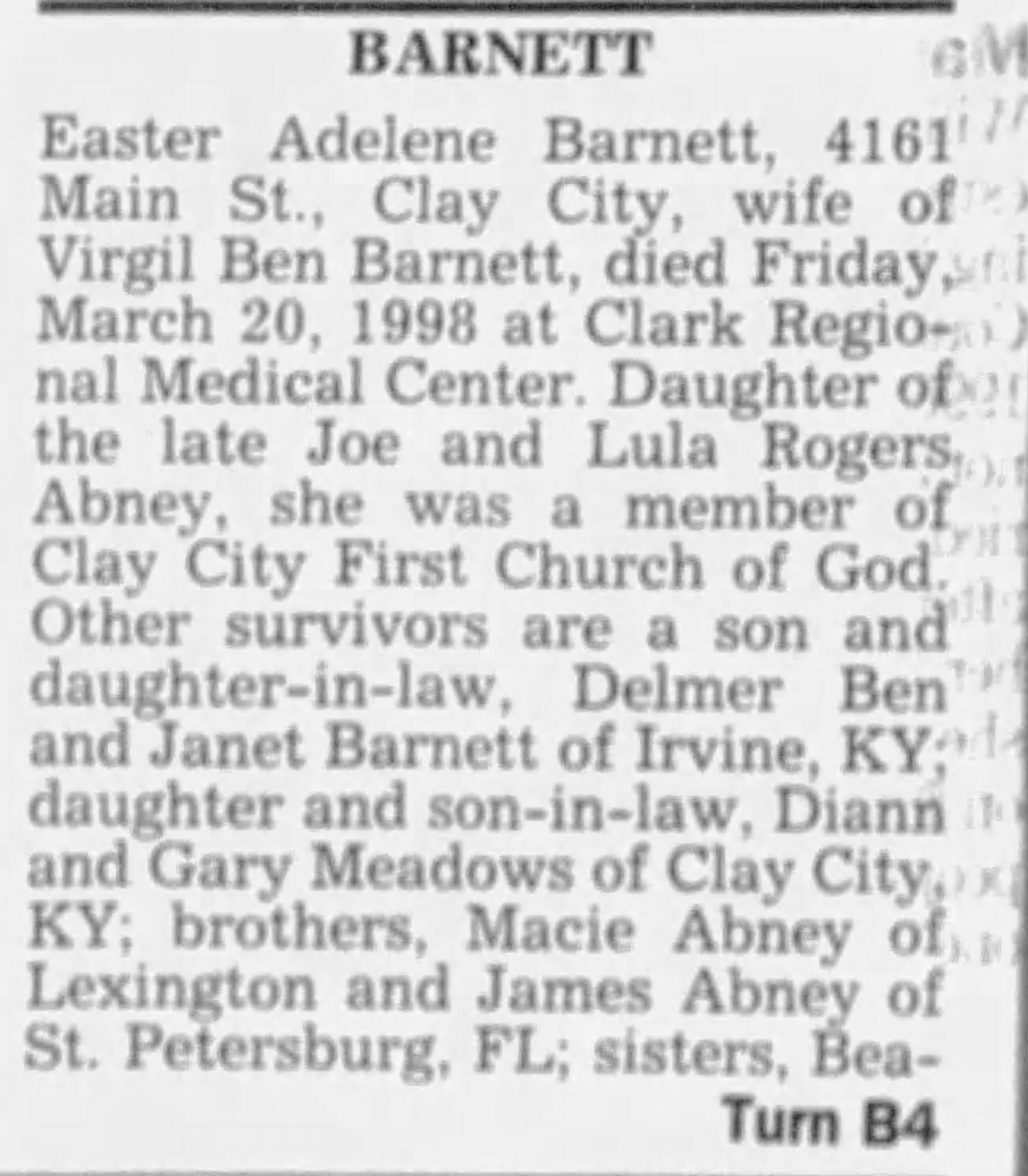
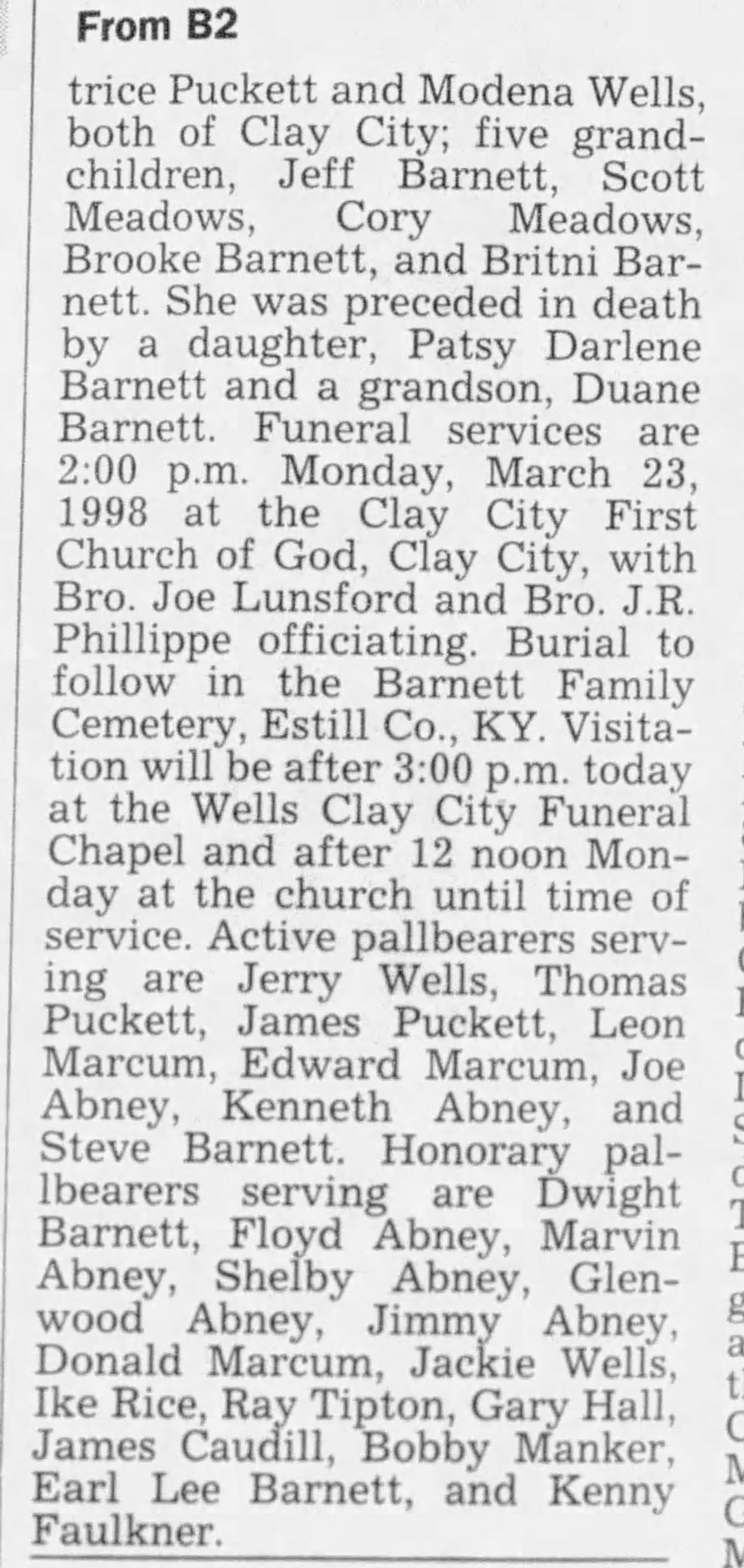
|
||||
| Barnett | Evelyn Jean | January 27, 2006 | Shelby & Effie Adams | Lexington Herald-Leader | January 29, 2006 |
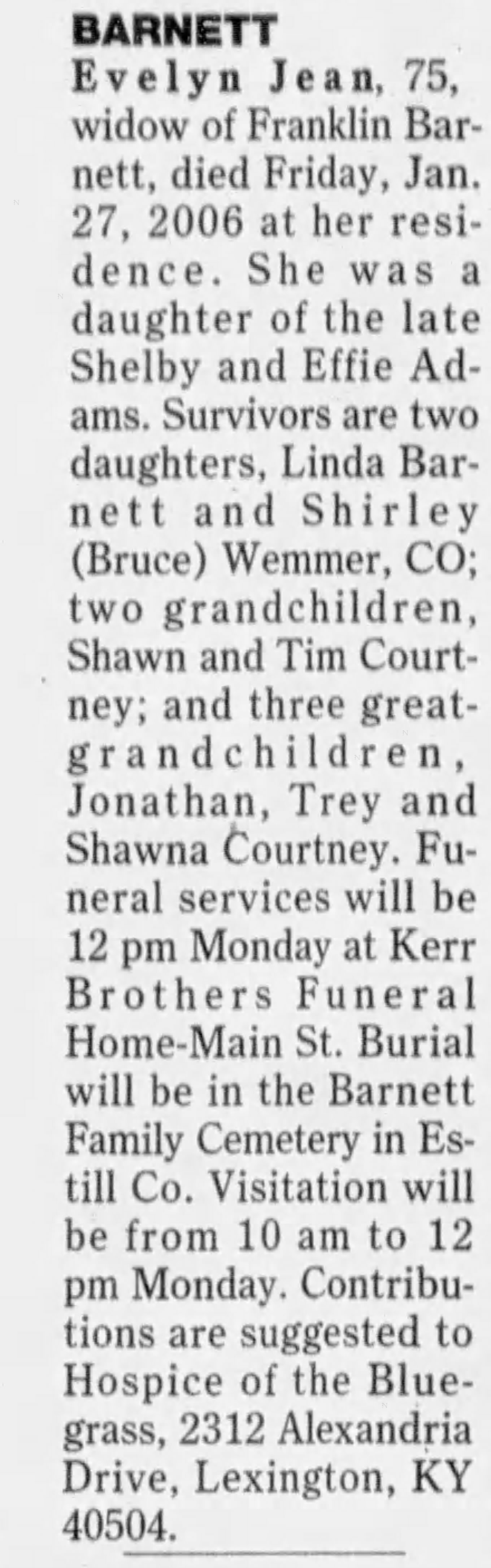
|
||||
| Barnett | James Franklin | March 31, 1887 | June 13, 1964 | Andy Barnett & Amanda Highley | Estill County, Kentucky | Clark County, Kentucky | 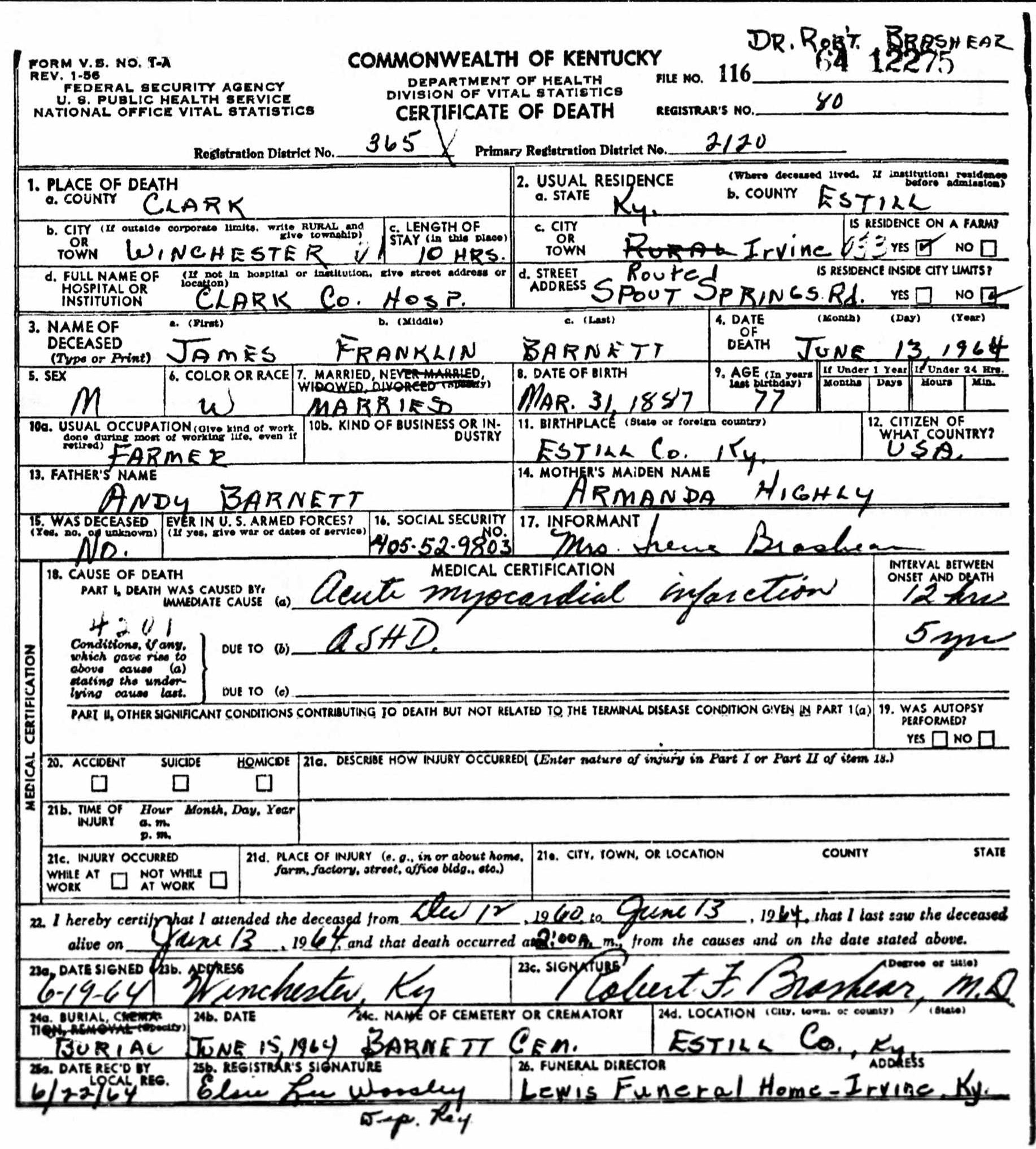 |
|||
| Barnett | Lourette | August 2, 1894 | January 27, 1917 | 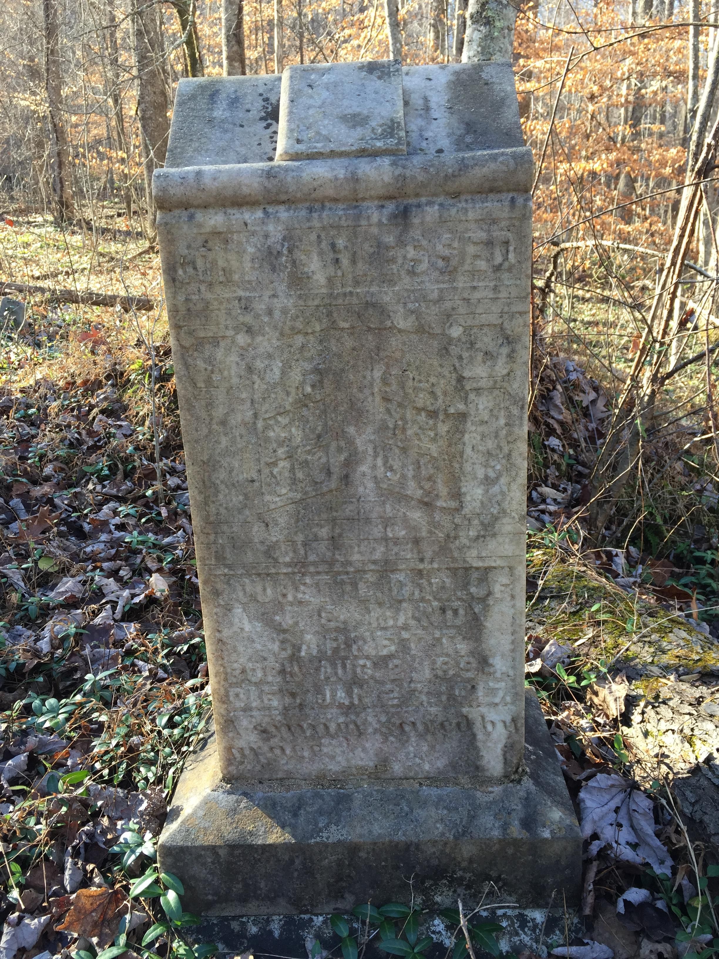 |
||||||
| Barnett | Omer | May 1, 1916 | July 18, 1916 | Benny Barnett & Mattie Dawson | Clark County, Kentucky | Clark County, Kentucky | 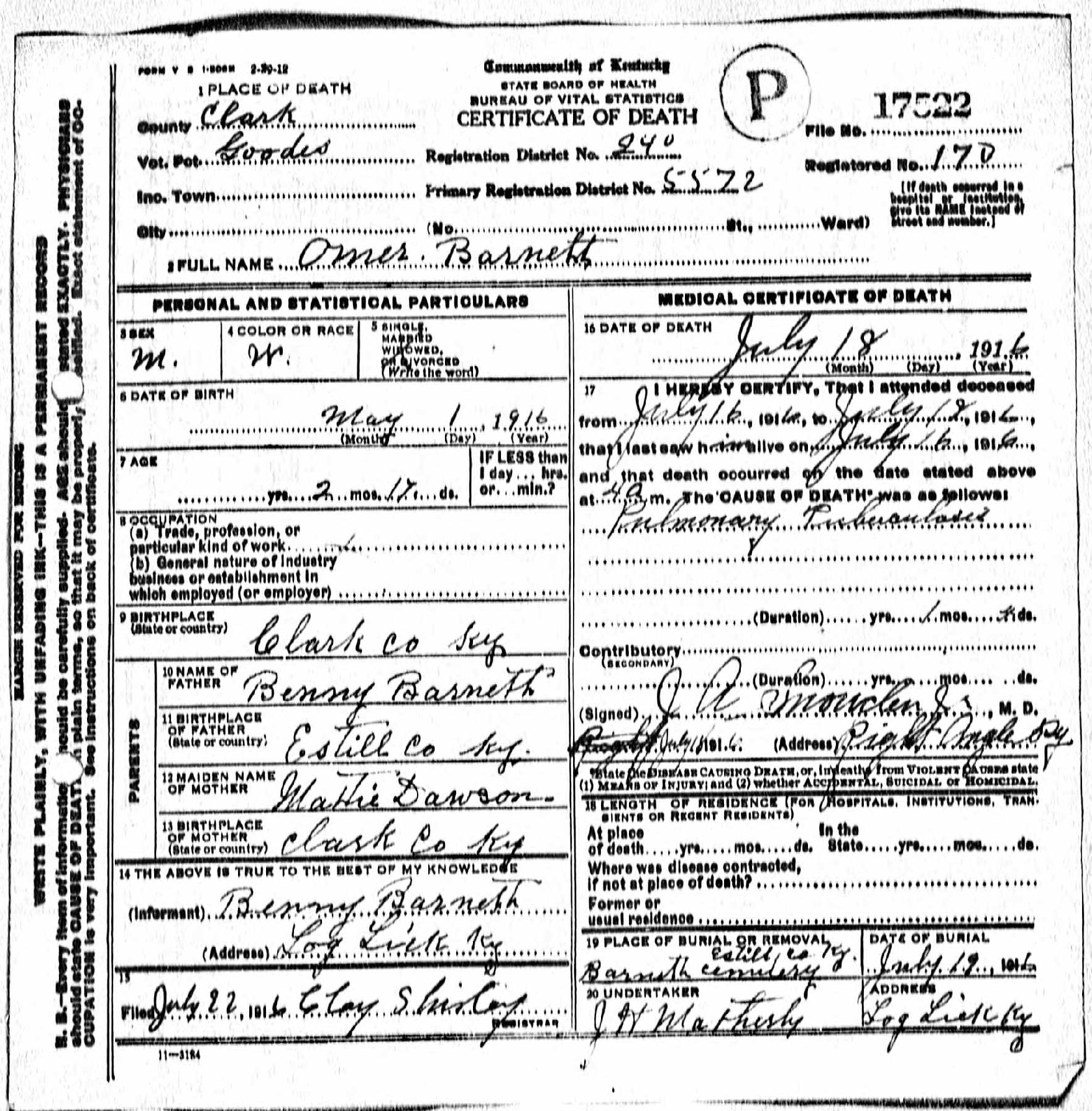 |
|||
| Milton | Rhoda Bell | September 14, 1925 | Oscar Milton & Christina Barnett | Powell County, Kentucky | Clark County, Kentucky | The Clay City Times | September 17, 1925 |
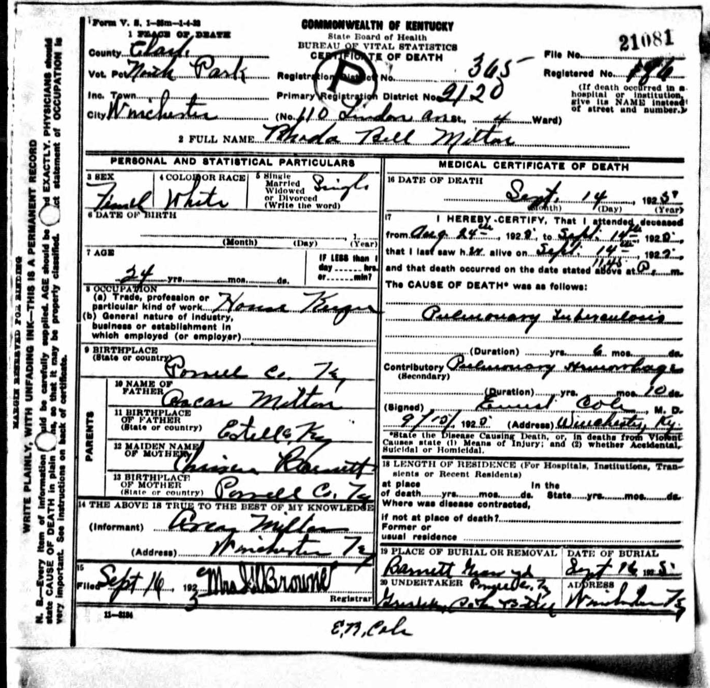
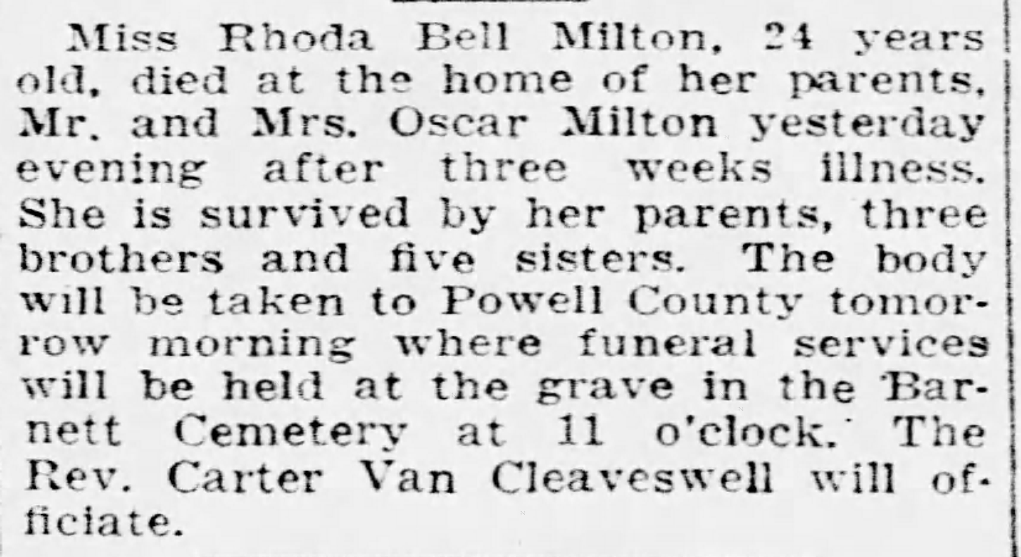
|
||
| Milton | Shirley | Oscar Milton | The Spout Springs Times | September 13, 1900 | 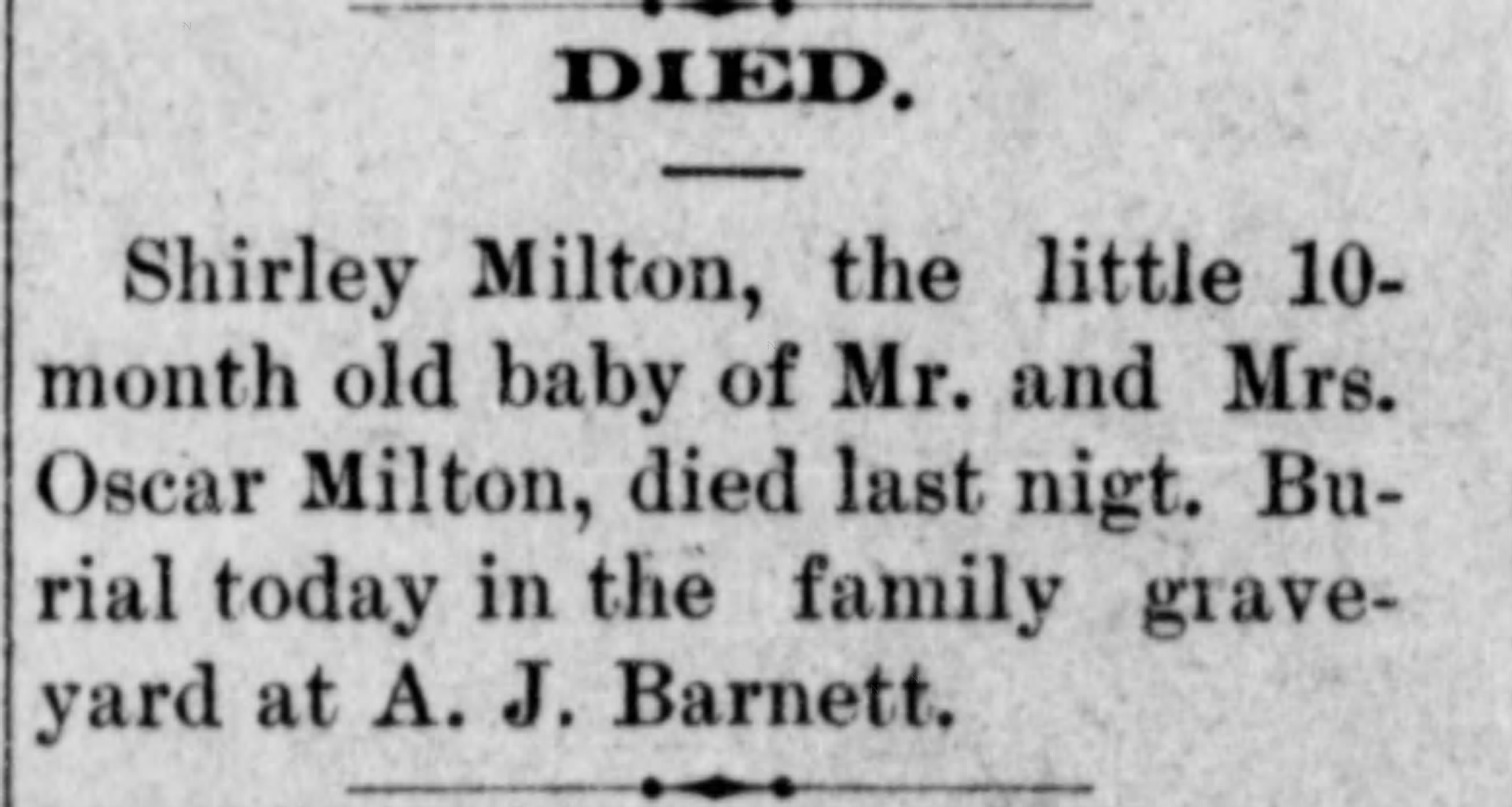 |
|||||
| Snowden | Infant | September 20, 1909 | Asa Snowden | The Clay City Times | September 23, 1909 | 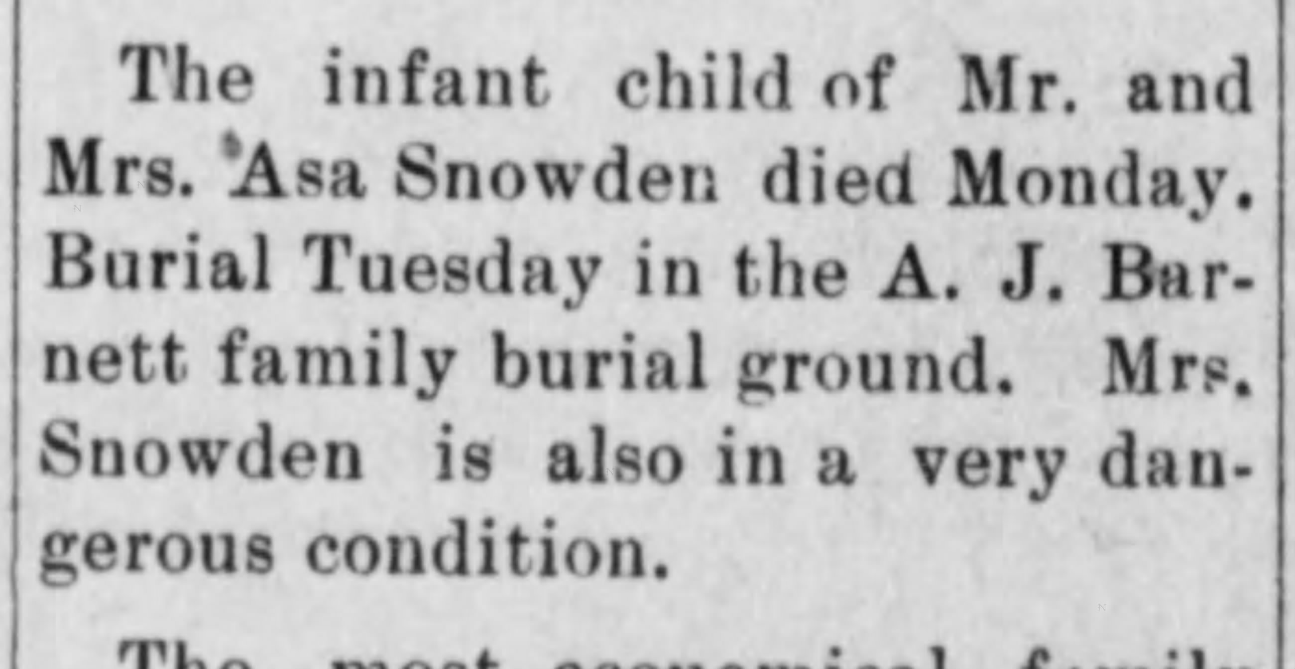 |
||||
| Snowden | Nancy J. | Barnett | June 14, 1888 | June 13, 1913 | Andy Barnett & Amanda Highley | Estill County, Kentucky | Powell County, Kentucky | 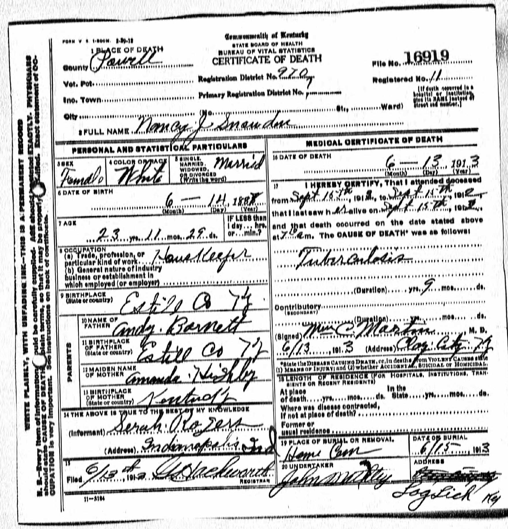 |
Cemetery records compiled and researched by Rebecca Miller. Empty fields indicate information that has not yet been entered; they do not lessen the confirmed burial status of the individual.
Research Notes and Sources
This page brings together cemetery records, death certificates, headstone photographs, obituaries, newspaper notices, family research, historical maps, and modern terrain study. Because the exact cemetery ground has not yet been conclusively relocated, the map coordinates and access description remain working research conclusions and may be revised if stronger evidence is found.
Mapping sources consulted include the 1905 Rand McNally historical map, the 1952 Clay City USGS topographic map, present-day aerial imagery, and Kentucky From Above Phase 2 LiDAR hillshade.
Help Us Preserve Our History
Do you have old photographs, newspaper clippings, obituary scans, family records, or firsthand knowledge concerning A. J. Barnett Cemetery and those buried there?
Every name has a story, and your contribution may help preserve details that would otherwise be lost.
Email: rebecca@rebeccas-treasures.com